
roaring creek
gps tracks
| roaringcreek.tcx |
Maps
|
overview
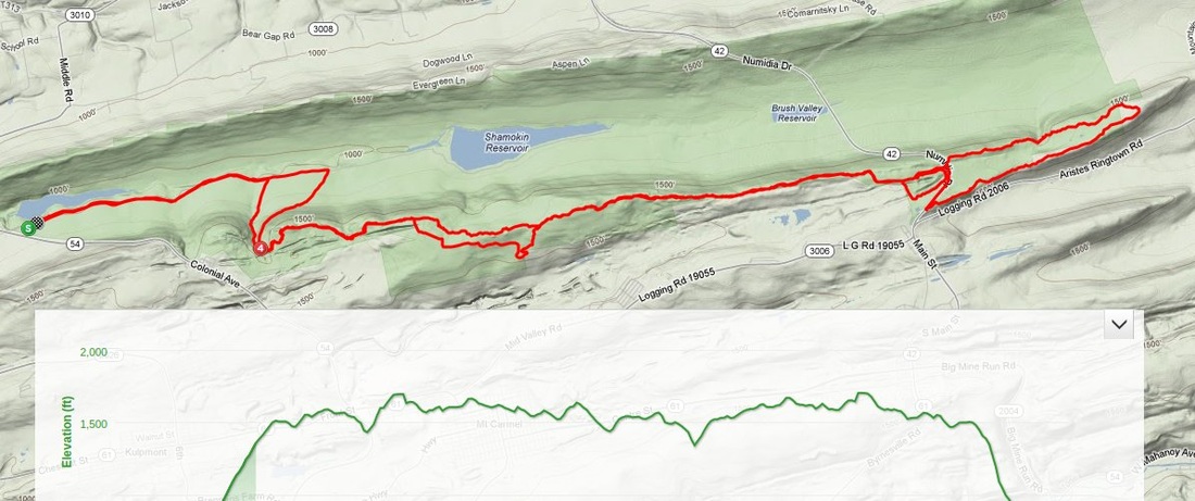
This route leaves from the Roaring Creek tract of Weiser State Forest near Mt. Carmel, PA (gps coordinates: 40.822188526884105,-76.49531364440918). On this ride you will warm yourself up on a brief portion of maintained dirt road before climbing to the top of the mountain where you will experience the area's best ridgeline singletrack that spans the length of the forest. On your way out the trail will deviate from the ridge and tease you with portions of singletrack that only local riders would be familiar with. After returning to the ridge you will eventually come to Rt 42 where you will climb a small section of pavement and then cross the road to hit the eastern portion of the forest. Here you will circle around with some more rocky ridgeline trail making your way back to Rt 42 where you will begin to double back on some of the same sections you had already ridden on your way out. Don't be fooled by the sections that you will double back on. Each direction will provide it's own challenges which will make you feel like you are on a completely new section of trail. Once you reach the end of the ridge you will drop back down the mountain on a fast and technical descent. From there you can cruise back to the parking lot with an easy cool down over the last couple of miles. Plan for at least 3 hours of riding time to complete this 27 mile ride.
|
